Land Labs’ geological mapping services, in partnership with industry leaders, help our clients identify the most promising onshore exploration targets and optimise future seismic, drilling, field sampling and environmental benchmarking activities.
We combine the spatial, spectral and textural information contained in satellite imagery and elevation data with our extensive geological expertise to improve knowledge of onshore geology and even enhance understanding of adjacent offshore areas.
The scarcity, variable specifications and quality of existing geological maps is a major obstacle for exploration teams. In contrast, our expert geological interpretation provides accurate surface geological maps that are easy to use, interrogate and integrate.
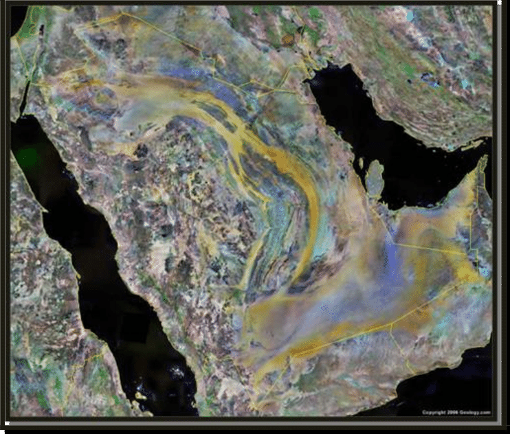
Simplified geological map of the Arabian Peninsula, showing the studied... | Download Scientific Diagram (researchgate.net)Kindly find the CC license geological map of Saudi Arabia.